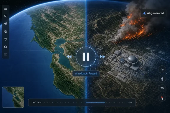
Google’s Nano Banana 2 image generator is no longer available in Google Earth, despite the July 30 rollout that promised historical reconstructions, construction visualizations, property concepts, and location-based infographics. Google rolled the feature back within roughly a day after users demonstrated that it could add plausible-looking disasters, military activity, infrastructure, and other fabricated events to recognizable real-world places.
That reversal changes the story considerably. The headline was not that Google Earth gained another generative-AI button; it was that Google briefly embedded a fast image-editing model inside a product that many people use precisely because they assume its imagery represents a documented view of a place. Google Earth’s underlying map data was not altered for other users, but that distinction does little once a convincing screenshot leaves the product.
Mashable’s original report, based in part on ZDNet’s early access testing, identified the mundane weakness of the implementation: it was often less useful than taking a Street View screenshot and editing it in Gemini directly. The subsequent reporting from PC Gamer,
The Atlantic, TechRadar, and others exposed the more consequential flaw: Google had made it unusually easy to combine synthetic content with the visual authority of Google Earth’s satellite, aerial, and 3D views.
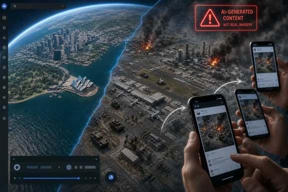 The July 30 feature did more than generate a separate picture
Google’s pitch was familiar to anyone who has watched Nano Banana spread through Gemini, Search, Lens, NotebookLM, Google Photos, and other Google products. Nano Banana 2 — formally Gemini 3.1 Flash Image — can create or edit an image from a text prompt, drawing on the company’s model knowledge and, in some cases, current web-connected information. Google promoted Google Earth as a new surface for the same capability: choose a location and ask for an altered or explanatory view.
The proposed uses sounded relatively harmless. A user could ask to see an area in a historical period, visualize a prospective building before construction, generate an infographic about a landmark, or restyle a property. For architects, planners, real-estate marketers, teachers, and hobbyists, an AI rendering that stays aligned with a particular parcel or building has obvious appeal.
But Google Earth gave the generated image something ordinary Gemini image generation does not: a trusted geographic frame. The base material brings familiar labels, landmarks, camera angles, satellite textures, Street View context, and a well-known Google interface. Those cues make a synthetic result feel less like an illustration and more like evidence.
That is the critical design error. The output did not have to rewrite Google’s shared map layer to be misleading. A user only needed to create an image, take a screenshot, crop away any interface elements that raised doubt, and circulate it in a group chat, social post, incident channel, or local-news thread. The recipient would see an apparent Google Earth view of a real place, not an editable AI canvas.
Google’s safeguards did not survive the obvious workflow
Google initially emphasized two safeguards: generated imagery carried the company’s invisible SynthID watermark, and harmful requests were subject to policy restrictions. PC Gamer reported Google’s position that people could use Gemini or Google Lens to determine whether an image had been AI-generated. Google also said the imagery was confined to the creator’s project rather than being inserted into the core Google Earth experience seen by everyone else.
Each claim is accurate as a description of a safeguard, but none addresses the actual distribution path that emerged almost immediately.
A hidden watermark is useful when the original file survives intact and someone knows to inspect it with a compatible detector. It is far weaker against screenshots, re-encoded images, crops, messaging-app compression, or a photo of a display. A verification workflow that requires the viewer to suspect manipulation first is also poorly matched to the speed at which local crisis imagery travels online.
The policy layer proved equally inadequate.
The Atlantic reported that it could create an aerial image depicting an aircraft striking the World Trade Center site, while a direct attempt in Nano Banana to make a similar terrorist-attack edit was refused. That inconsistency matters because it suggests the problem was not simply one missing keyword filter. The Google Earth integration changed the contextual route through which an otherwise disallowed visual could be approximated.
404 Media reported examples involving fabricated refugee activity near the U.S.-Mexico border, a nuclear facility in Iran, and a fatal crash in Amsterdam. PC Gamer documented how readily the feature could turn a real hometown into a war-zone scene. These were not obscure edge cases discovered after months of adversarial research; they were foreseeable abuse patterns for a tool that accepted free-form prompts on top of actual locations.
Google’s later statement acknowledged the larger issue directly: people
uniquely trust Google Earth as a reliable view of the world. The company said it had seen useful professional applications but was rolling the feature back while it developed stronger guardrails after screenshots that appeared to violate its policies circulated online.
ZDNet’s early test also showed why the advertised uses were shaky
The misinformation risk was severe, but ZDNet’s pre-launch experience indicates that Google Earth’s practical value proposition had not been settled either. The outlet found that the Create Image control was unavailable in Street View, making one of the most natural location-editing workflows unavailable in the product itself. Capturing Street View and sending the screenshot to Gemini was simpler.
Its testing of Google’s “bring history to life” idea also found that the model delivered period-flavored imagery rather than historically verified reconstruction. An AI-generated scene around Philadelphia’s Independence Hall could look broadly appropriate to a requested era while inventing or omitting the buildings and surroundings that actually existed there.
That is a major limitation, not a cosmetic one. An historical visualization needs source boundaries: dates, known structures, uncertain details, archival inputs, and a plain statement of what was reconstructed versus imagined. Nano Banana produces an image by probability, not by establishing an auditable historical record. Google’s use of the phrase “bring history to life” invited users to blur that boundary.
The same issue appeared in ZDNet’s infographic tests. Generated graphics changed the physical layout of locations and contained garbled or nonsensical text. Nano Banana 2 may be better at in-image text than earlier image generators, but a location infographic is only useful if labels, routes, dimensions, and relationships are correct. Google Earth already provides geographic data and layers; replacing those with a plausible-looking but unverified image creates a worse research tool.
A future return needs provenance that survives outside Google Earth
Google has not provided a relaunch date, a revised feature specification, or a public explanation of what the new guardrails will be. As of August 5, the immediate operational guidance is straightforward: users should assume that any screenshot claiming to show a new Google Earth discovery may be synthetic unless it can be independently verified against the live location, source imagery date, and other imagery providers.
For IT administrators and security teams, the short-lived feature is a reminder that browser-delivered consumer AI tools can create an evidence problem even when they never touch corporate systems. Screenshots of a supposed damaged facility, protest, accident, or construction event can reach an organization’s chat, ticketing, or incident-response workflow with the credibility of a familiar mapping product behind them. The right first response is not to decide whether the picture
looks authentic, but to identify its origin and corroborate the underlying event.
Google cannot solve that problem merely by making the watermark detectable after the fact. If it brings Nano Banana back to Google Earth, the product will need a visible, persistent, screenshot-resistant indicator that remains attached to the generated portion of the view; a firm separation between observed map imagery and imagined rendering; and restrictions that account for the location itself, not only the words in a prompt.
The company’s rollback was the correct immediate action. Its more difficult task is deciding whether a product used to inspect the real world can host fictional renderings at all without turning every Google Earth screenshot into something viewers must treat as unverified.

 A Short-Lived Experiment in a Trusted Mapping Product
