

Microsoft HASTE moves damage assessment into the first response window
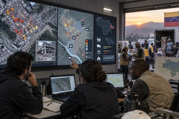
In Microsoft Source’s September 22 feature, Carlos Rivas, a disaster-risk-management specialist at Catholic Relief Services, describes the immediate problem after the Venezuela earthquake. Once he had established that local staff and volunteers were safe, he needed to identify the hardest-hit communities. Reports were arriving, but choosing a destination without a broader damage picture risked committing a team to a long journey while a worse-affected community waited elsewhere.
Rivas contacted Microsoft’s AI for Good team shortly after the June 24 earthquake. By the following morning, he had a damage-analysis map. Catholic Relief Services and its local partner, Caritas Venezuela, used the assessment to identify severely affected areas and prioritize assistance.
The comparison with the organization’s existing process is striking, but specific. Nora Lindstrom, who leads Catholic Relief Services’ global digital programming team, told Microsoft that producing a comparable assessment would have taken her organization about two weeks, using analysts, imagery and a much more manual workflow. That is an estimate of the organization’s alternative process, not a controlled benchmark showing that every HASTE deployment replaces two weeks of work.
For an aid organization operating in approximately 95 countries, shortening that process changes when an assessment can contribute. An overnight map can inform initial resource allocation; an assessment completed two weeks later has a different role in an ongoing response. Rivas described the stakes through a possible 12-hour journey over difficult terrain: better information can help a team choose its destination before it commits those hours.
The reported outcome is earlier access to decision-making information. Microsoft’s feature includes humanitarian workers explaining how that can support lifesaving work, but it supplies no measured reduction in rescue times or count of lives saved attributable to HASTE. The strongest supported conclusion is that the Venezuela team received a useful damage picture early enough to help prioritize its response.
That direction fits Microsoft’s broader account of disaster-response AI. At the July 2026 AI for Good Global Summit, Microsoft President Brad Smith described combining satellite imagery, predictive modeling and public data to identify vulnerable communities and accelerate response, as reported by GZERO Media. That appearance provides context for Microsoft’s stated approach, not independent verification of HASTE’s Venezuela results.
HASTE learns the disaster in front of the analyst
HASTE stands for High-speed Assessment and Satellite Tracking for Emergencies. Microsoft describes it as a free, open-source platform that helps analysts turn overhead imagery into building-level damage assessments. In the workflow illustrated by Microsoft Source, imagery from before a disaster establishes the original condition of buildings, while new imagery reveals visible changes. An analyst identifies examples of damaged and undamaged buildings, and the system applies those patterns across a larger area.
The important technical detail is that HASTE can learn from the current scene. Buildings vary between regions, and different disasters leave different visual signatures. Microsoft Research’s July 2026 HASTE description explains that conventional benchmark-oriented approaches often assume both matched before-and-after imagery and training examples from similar past events. Those conditions may be unavailable during a new disaster’s first day.
HASTE’s research description sets out two methods behind a shared, no-code web interface. Both let an analyst provide examples from the affected area, but they process those examples differently:
| HASTE method | What the analyst supplies | How the assessment is produced |
|---|---|---|
| Scene-specific segmentation | The analyst labels polygons over a post-disaster image. | A small model learns from that scene, classifies pixels across the image and combines the results with existing building footprints. |
| Footprint-based classification | The analyst labels a small number of individual buildings. | A pretrained vision model creates numerical representations of building imagery; a logistic-regression classifier fitted in the browser scores the other buildings. |
In the first method, semantic segmentation means classifying parts of the image at pixel level. The subsequent join to building footprints—mapped outlines of individual buildings—turns those image-level results into a building-level assessment. That last step is important for the intended output: responders need a map of structures that appear affected, not simply an image with classified pixels.
The second method starts with the individual footprints. A pretrained vision model supplies embeddings, numerical representations of the visual information associated with each building. The analyst’s labels then give a smaller classifier examples of what counts as damaged or intact in that scene. Microsoft Research says the browser-based classifier can score the remaining scene in seconds, but that timing describes a processing stage, not the entire interval from disaster to delivered assessment.
The research also establishes a useful boundary around the before-and-after explanation. Although Microsoft Source illustrates a workflow using both, the research describes assessments from post-disaster imagery alone. Paired imagery therefore should not be presented as a universal prerequisite for every HASTE method. The platform’s intended advantage is precisely that an analyst can work with the current disaster rather than waiting for the ideal historical comparison and a closely matched training set.
HASTE’s research results separate fast scoring from fast delivery
Microsoft Research reports preliminary experiments using xBD, a disaster-imagery dataset, in which foundation-model embeddings pooled over building footprints distinguished damaged from intact buildings using only post-disaster imagery. The researchers say that approach matched a fully supervised ResNet-50 baseline while using one-twentieth as many labels. This supports the technical case for extracting useful information from a small amount of analyst labeling.
The result has a particular scope. It compares a research approach with a specified baseline on a dataset; it does not establish a universal field accuracy rate, a twentyfold improvement in overall response speed or a twentyfold reduction in staffing. For a prospective user, its significance is that the method may reduce the labeling burden needed to build a useful scene-specific classifier.
Operational timing involves more than classification. Microsoft Source describes a few hours of situation-specific training, followed by analysis across territory that would take people days or weeks to inspect manually. The research description reports delivery to humanitarian partners within hours to days of imagery becoming available. Those clocks start at different points, and the imagery-availability condition belongs beside any promise of rapid assessment.
The deployment counts also require care. Microsoft’s September feature says relief organizations and government agencies have used HASTE after 23 major disasters in 16 countries since 2023. The July research description says HASTE and its predecessors supported more than 30 real-world disaster responses over that period. Those are differently scoped figures; the published descriptions do not provide a reconciliation that would justify combining them into one total.
For an IT or humanitarian program manager evaluating the system, the useful questions follow from those distinctions. How soon can suitable imagery arrive? Who can label the current scene? How will the resulting assessment reach operational teams? The documented seconds-long scoring stage is valuable, but the Venezuela experience shows that the meaningful deliverable is the usable map in a responder’s hands.
OCHA’s Azure viewer makes HASTE part of a shared evidence picture
After the Venezuela earthquake, the United Nations Office for the Coordination of Humanitarian Affairs, or OCHA, received the HASTE analysis and distributed it through a humanitarian network used by thousands of people across government, nonprofit organizations, local authorities and emergency-response teams. According to Microsoft Source’s reporting, that helped organizations develop a common picture of where damage appeared most severe, estimate needs and plan operations.
OCHA humanitarian affairs officer Fawad Hussain Syed described the immediate coordination problem: arriving search-and-rescue teams need a destination. Messages, news reports, social-media posts and field observations can all contribute information, but they arrive in fragments. A geographically organized assessment gives coordinators another basis for deciding where teams and equipment should go.
More information then created a second problem. Organizations were receiving so much imagery and analysis that comparing the products became difficult. OCHA data scientist Zachary Arno built an Azure-hosted web viewer that brought HASTE assessments together with eight other disaster-mapping products. The viewer let organizations compare them in one place, rather than treating each incoming assessment as a separate picture of the emergency.
HASTE’s accompanying metadata and confidence rankings helped Arno incorporate its results into that broader view. The operational lesson for enterprise technology readers is concrete: the assessment’s usefulness depended partly on what traveled with it. Confidence information and descriptive context made it easier to interpret alongside other products and communicate across organizational boundaries.
This is also where Microsoft’s warning about accuracy becomes more than a slogan. “If you have fast garbage, that’s actually worse,” Kevin White, a senior director at Microsoft’s AI for Good Lab, told Microsoft Source. A rapid map can influence where limited resources go, so its apparent precision needs to remain connected to the strength of its evidence. The documented response was to support comparison and interpretation, with HASTE contributing one assessment to a larger operational picture.
Azure’s established role in this account is hosting OCHA’s viewer. The reporting does not establish a mandatory Azure subscription, Windows edition or Microsoft 365 license for every HASTE user. An organization considering adoption should keep the analyst tool, the imagery workflow and a separately hosted sharing service distinct when assessing its own requirements.
Open-source HASTE lets local teams extend the assessment
Catholic Relief Services’ Venezuela work went beyond identifying damaged buildings. Rivas recognized that knowing where help was needed would not solve the journey if damaged roads or bridges prevented access. Microsoft Source reports that he adapted the HASTE analysis to evaluate routes, identify potential obstacles and suggest alternatives.
That extension is an important example of local adaptation, with a technical boundary. The report describes what Rivas did with the analysis; it does not provide a general route-planning procedure or establish that a complete road-and-bridge assessment feature ships in every HASTE installation. Indeed, Microsoft Research identifies damage models for roads and other infrastructure as a promising future direction. Readers should distinguish the reported local workflow from a documented, generally available platform capability.
Rivas also used mapping to show tarp distribution, giving donors a geographical view of how funds provided shelter in badly damaged neighborhoods. Together, the route and distribution examples show why open-source availability matters here: the organization could shape the technology around its local partner’s work. The immediate building assessment became an input to access planning and aid accountability.
Microsoft says HASTE has become the AI for Good team’s primary disaster-response assistance platform. During major emergencies, that team works with humanitarian partners and imagery providers, including Planet Labs, to process images, generate assessments and distribute information. The open-source software sits within that collaborative process; software availability alone does not supply imagery or people able to interpret a scene.
The feature also places local capability in a broader set of responses. Rivas points to fires in Bolivia and floods in Peru, Paraguay and Ecuador as examples of smaller emergencies that may receive less international attention. He and Syed describe growing familiarity with AI assessments, including HASTE maps informing decisions within an hour of an August earthquake in Colombia. Those remain Microsoft’s reported examples, rather than standardized timing measurements across deployments.
The account of the August 2026 Spokane-area wildfires illustrates a different operational use. Tristan Allen of Washington’s Emergency Management Division sought an early estimate of affected structures while firefighters were still battling the fires. HASTE’s assessment helped emergency managers begin estimating displaced households before formal assessments were complete. Its contribution was to bring resource planning forward, while leaving the formal assessment process its own role.
HASTE preparedness and Nextdoor integration have different maturity levels
The same damage information can remain useful after the first response. Catholic Relief Services is using assessment data from Hurricane Melissa, which struck Jamaica in October 2025, to help plan shelters in areas vulnerable to future storms, according to Microsoft Source. That is a reported preparedness use of past damage data, extending the value of the assessment beyond the incident that produced it.
The Nextdoor example is at an earlier stage. After seeing HASTE’s Spokane assessment, Joseph Porcelli, who coordinates with public agencies for Nextdoor, compared the information with the service’s database and found that most affected households were members. He began working on a program to connect HASTE information with the platform so local governments with official accounts could target more geographically specific emergency messages.
The proposed use addresses a separate information problem: people affected by a disaster need to know where to find water, food, shelter, medicine or somewhere to charge a phone. A damage assessment could help an authorized local agency select a more relevant area for a message. That is a plausible extension of the map’s geographic detail, but the report describes a program in development, not a broadly available emergency-notification integration.
These examples should stay separate in an adoption decision. Catholic Relief Services’ use of existing data for shelter planning is reported as underway. Nextdoor’s connection is exploratory, and Microsoft Research’s road-damage models are a research direction. None should be folded into a single claim that HASTE already supplies an end-to-end system for damage detection, access planning and public notification.
What HASTE means for humanitarian IT teams
Humanitarian organizations evaluating HASTE should begin with the damage-assessment workflow they can actually support: obtaining imagery, assigning analysts and putting an interpretable map in front of the people making response decisions. The Venezuela deployment provides a credible first-party account of that workflow producing an overnight result. The research gives a more specific explanation of how limited local labeling can support building-level assessment.
The evidence supports these practical distinctions:
- Choose the intended imagery workflow explicitly: Microsoft illustrates before-and-after analysis, while the research also describes methods using post-disaster imagery alone.
- Plan for analyst participation, because both documented methods require people to label examples from the affected scene.
- Measure delivery from imagery availability through assessment sharing, rather than treating seconds-long classifier scoring as the complete response time.
- Preserve metadata and confidence information when sharing results, following the documented OCHA example of comparing HASTE with other mapping products.
- Treat CRS’s route analysis and aid-distribution mapping as local adaptations, and Nextdoor’s proposed connection as work in development.
The available reporting does not provide a verified installation procedure, hosting specification, imagery-acquisition cost or operational support commitment. Those details would materially affect a production deployment, so this is evidence for evaluating HASTE’s workflow rather than a deployment runbook. Its free, open-source status establishes access to the software; it does not establish the total cost of running an assessment service.
HASTE’s most consequential contribution in these deployments is the earlier arrival of geographically specific information that organizations can compare, share and act on. Venezuela’s overnight assessment, OCHA’s multi-product viewer and Washington’s early wildfire estimates show different parts of that process already in use. For teams considering the technology, the supported next step is to build the local capacity around the map—imagery access, analyst judgment and a reliable handoff to responders—so faster analysis becomes a faster operational decision.
References
- When disaster strikes, AI helps responders reach people more quickly - Microsoft Source Microsoft Source · Tue, 22 Sep 2026 14:59:57 GMT
- HASTE: A Platform for Rapid Post-Disaster Building Damage Assessment - Microsoft Research microsoft.com