

That distinction matters because the phrase “foundation model” can imply a broadly capable system ready for operational deployment. The available materials instead describe a reusable starting point for lunar-science tasks such as mapping surface features. The intended value is to reduce the task-specific labeled data needed for some experiments while retaining a clear boundary between a research output and a mission decision.
What NASA and IBM have released
The NASA-IBM Lunar Foundation Model is a multimodal, multi-resolution model for lunar remote sensing. NASA and IBM have published it through Hugging Face, alongside materials intended for testing and experimentation. The model is designed to work with spatially aligned types of lunar observations rather than treating one image as the complete scientific picture.
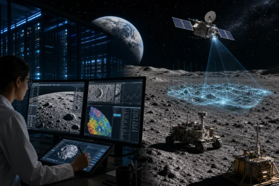
That approach matters because lunar terrain is observed in complementary ways. High-resolution imagery can reveal small craters, boulders, and fine surface texture. Broader imagery provides regional context. Terrain data can expose slopes, elevations, and landforms that may not be evident in grayscale images alone. Further contextual layers can contribute signals relevant to surface and subsurface conditions.
The training materials draw primarily on NASA’s Lunar Reconnaissance Orbiter, or LRO, with additional imagery or terrain information from the GRAIL mission, Lunar Prospector, and Japan’s SELENE mission. LRO has studied the Moon since 2009 and has produced detailed observations of the surface, temperature, composition, and radiation environment. Those observations already inform research into potential landing locations and polar resources; the new AI work aims to make some analytical workflows more adaptable.
The public model repository uses an Apache-2.0 license, supporting the description of the model release as open source. That does not mean every upstream observation product has been placed under the same license. Developers still need to check access conditions, attribution requirements, and reuse terms for each dataset, benchmark, or mission archive used in a project.
A research model, not a spacecraft decision-maker
The difference between research support and operational use is not a routine disclaimer. The documentation says the model has not been validated for mission decisions including landing-site certification, hazard clearance, in-situ resource utilization prospecting, or traverse planning.
Those decisions require far more than a capable image-analysis model. Landing assessment can depend on slopes, rocks, illumination, communications geometry, thermal conditions, vehicle capabilities, navigation uncertainty, and surface properties. Each input carries uncertainty, and the overall process needs engineering validation and accountable human authority. A promising segmentation mask or crater map may be informative, but it is only one input to a much larger safety-critical process.
The strongest near-term role for this release is therefore earlier in the research pipeline. Scientists could use it to explore hypotheses, prioritize areas for manual review, prototype map-generation methods, or test whether a modest labeled dataset can adapt the base model to a specialized question. These are meaningful uses, but they are distinct from certifying a landing site or directing a rover.
That boundary also guards against a common AI error: turning a probabilistic pattern or proxy output into a real-world conclusion that the model has not established.
Polar ice prospectivity is a proxy, not an ice discovery
The polar ice-prospectivity task is likely to attract the most public interest, and it needs the most careful interpretation. Its target is a knowledge-driven fuzzy-overlay prospectivity map. Put simply, the downstream model is trained to emulate an expert-designed representation of where conditions appear favorable under a defined prospectivity framework.
It is not directly measuring ice. It does not estimate ice volume, purity, accessibility, or economic value. Nor does a high-prospectivity pixel or region prove that ice is present there.
This is more than a technical wording issue. Lunar water ice could potentially matter for future exploration, including life-support, shielding, and propellant-related concepts. That strategic interest makes it easy to overstate preliminary outputs. A prospectivity-map emulation can help organize follow-up research and compare candidate regions, but confirmation requires suitable observations and scientific validation beyond reproducing a reference map.
The same restraint applies to resource claims. An area worthy of further study is not the same thing as a verified, recoverable resource. The stated lack of validation for operational prospecting is a direct acknowledgment of that evidentiary gap.
What the benchmark results actually show
NASA reports that the model matched or exceeded several cited baselines across its evaluated tasks. That overall conclusion should not be reduced to a claim that it wins every benchmark.
For Wide Angle Camera, or WAC, crater detection, the model leads the cited baselines. That result is encouraging because WAC imagery provides broad coverage and can be valuable for regional mapping work. For meter-scale Narrow Angle Camera, or NAC, crater detection, the model is statistically comparable with the best cited baseline rather than demonstrably ahead of it. That distinction is important: a very small score difference is not necessarily meaningful evidence of a superior model.
Irregular-mare-patch segmentation is similarly near parity with the cited comparison models. The largest reported margin appears in the polar ice-prospectivity task, but that result must retain its task-level qualification: it reflects stronger emulation of a knowledge-driven prospectivity map, not a direct prediction, detection, or measurement of ice stability or ice deposits.
The detailed evaluation notes offer an additional reason for caution on crater claims. They say crater benchmarks have small test sets and warn that differences below the variation associated with different training seeds should not be treated as a ranking. High-resolution lunar coverage can also be limited to particular locations, which complicates attempts to generalize performance to every geological setting or lighting condition on the Moon.
None of this negates the reported results. Instead, it makes the most defensible interpretation more useful: the evaluation makes the release worth testing, while independent replication, wider datasets, and careful error analysis remain essential before broad claims are made.
Why the foundation-model approach is useful
Many scientific computer-vision efforts begin with a narrow task: collect data, label it for one question, train a model, then repeat the process for another question. A foundation-model approach seeks to learn reusable representations from a larger body of related observations, then adapt the model for individual applications.
That could be particularly helpful in lunar research, where multiple observations describe the same terrain in different ways. A researcher studying craters, volcanic features, surface morphology, or polar environments may benefit from a model that has already learned relationships among imagery, terrain, and aligned contextual layers.
The possible advantage is experimental efficiency, not automatic scientific certainty. Fine-tuning on a smaller labeled dataset is useful only if those labels represent the places and conditions where the adapted model will be evaluated. A model can perform well on one terrain type yet fail on locations, illumination patterns, resolutions, or geological contexts that were poorly represented in its development data.
The release should also be viewed as part of a growing field rather than as an uncontested first. NASA describes it as among the first open-source AI models built specifically for lunar science. That careful phrasing is appropriate because other publicly available lunar remote-sensing foundation-model research exists. The more significant development is the emergence of accessible models and benchmarks that let outside researchers compare methods and test reproducibility.
Practical implications for Windows users
This is not a consumer Windows application comparable to an AI assistant, photo editor, or desktop search feature. It is a research asset consisting of model materials, code, documentation, and downstream-task resources that need to be evaluated in an appropriate machine-learning environment.
The most immediate opportunity is for university labs, data-science teams, and technically experienced enthusiasts already comfortable with Python-based AI workflows. They can test reproducibility, adapt the model on properly licensed lunar data, compare it with published baselines, and inspect errors rather than relying on a headline metric. Windows workstations can take part in such work locally, through a Linux-oriented development environment, or with external compute services, depending on the tools and hardware a project requires.
Public access does not eliminate the normal engineering and scientific work. A responsible experiment still needs a clearly defined task, clean data preparation, documented training and test separation, appropriate comparison baselines, and error analysis. It also needs licensing discipline: the model license does not automatically determine the rights attached to external input data.
For organizations, the sensible immediate use is educational and exploratory. Teams can study multimodal geospatial AI, experiment with model adaptation, and build research prototypes. Any operational claim would require a different validation program, including domain-specific performance targets, failure-mode testing, independent review, and clear human responsibility for consequential decisions.
Openness matters, but so do the limits
Making the model publicly available gives researchers an opportunity to examine it rather than accept a marketing claim at face value. They can test whether its reported performance transfers to new datasets, investigate biases created by observation coverage and labels, and develop stronger downstream methods. That scrutiny is especially valuable in lunar science, where observations are rich but finite and where eventual decisions can be expensive or safety-critical.
NASA and IBM’s release is therefore best understood as a potentially useful shared platform for lunar-science research. Its strongest case is not that it has solved Moon exploration. It is that it offers a reusable starting point for asking questions across multiple kinds of lunar remote-sensing data.
Its boundaries are equally important. It does not certify landing sites, clear hazards, plan rover traverses, detect lunar ice, or quantify a usable resource. Its polar ice-prospectivity task emulates a knowledge-driven prospectivity map. Keeping that distinction intact is the best way to recognize the model’s genuine scientific value without turning a research benchmark into mission-ready certainty.
References
- NASA-IBM LFM — Crater Detection NASA-IBM AI4Science on Hugging Face
- NASA-IBM LFM — Polar Ice Prospectivity NASA-IBM AI4Science on Hugging Face
- NASA Lunar FM Bench Registry of Open Data on AWS