
That shift matters because floods are no longer a distant or occasional planning problem. Extreme rainfall, rapid urban development, altered drainage patterns, reservoir operations, land-use changes, and climate-driven weather volatility are making conventional warning workflows less reliable on their own. Kerala’s devastating flood experience, along with repeated cloudbursts and urban inundation events around the world, illustrates the limitation of a warning system that reports a water level only after communities are already exposed.
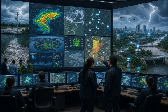
The replacement for traditional flood warning is not a single AI model, a satellite feed, or a futuristic quantum computer. It is a layered, interoperable flood intelligence platform that preserves the proven value of physical gauges and hydrological expertise while connecting them to modern sensing, simulation, automation, and impact-based communication.
For governments, disaster-management agencies, utilities, and city planners, the central challenge is therefore not simply buying more technology. It is building a resilient system in which every component—from a low-cost rain gauge to a high-performance computing cluster—contributes reliable, actionable information.
 Background: Why Traditional Flood Warning Systems Are Under Pressure
Traditional flood forecasting systems have saved lives for decades. Their foundation is straightforward: measure rainfall, observe river levels, compare conditions with historical patterns, run hydrological calculations, and issue warnings when thresholds are crossed.
That approach remains essential. A river gauge is still one of the most direct ways to see whether a river is rising, and local hydrologists continue to possess knowledge that cannot be extracted from a spreadsheet alone. The problem is not that conventional systems are useless. The problem is that they are often too fragmented, too slow, and too narrowly focused for the pace and complexity of modern flood risk.
A major river flood can develop over hours or days, allowing time for basin-scale monitoring and forecasting. Flash floods and urban floods are different. A cloudburst can overwhelm drainage infrastructure within minutes. In dense cities, water may collect in underpasses, low-lying neighborhoods, subway entrances, construction sites, and informal settlements long before a nearby river reaches an official warning stage.
Traditional systems may also struggle with limited observation coverage. A few rain gauges cannot always capture highly localized downpours. A single river-level station cannot reveal what is happening throughout a watershed. Manual data collection creates further delay at precisely the moment when emergency officials need immediate situational awareness.
The modern flood-warning challenge has several dimensions:
- More variable rainfall patterns, including short-duration, high-intensity precipitation.
- Fast-growing cities with extensive paved surfaces and stressed drainage networks.
- Greater exposure, as homes, roads, hospitals, data centers, and industries expand into flood-prone areas.
- Interconnected infrastructure, where one flooded road, substation, bridge, or pumping station can trigger wider disruption.
- Public expectations for immediate alerts, delivered through smartphones and digital platforms rather than through radio or television alone.
- Climate uncertainty, which makes historical flood behavior a less complete guide to future events.
An intelligent system must account for this entire chain: hazard, water movement, exposure, vulnerability, disruption, response, and recovery.
From Isolated Gauges to a Cyber-Physical Flood Network
The first major upgrade is the transition from isolated monitoring stations to a cyber-physical network. In practical terms, this means connecting large numbers of physical sensors and observation systems to software platforms that can process, validate, visualize, and act upon incoming data.
The Expanding Role of IoT Sensors
The Internet of Things has become a natural fit for flood monitoring because floods are fundamentally a real-time information problem. Water conditions can change rapidly, and the most useful data is often the data collected closest to the event.
A modern sensor network can include:
- Rain gauges measuring precipitation intensity and accumulation.
- River and stream gauges monitoring water level and flow.
- Soil-moisture sensors identifying whether the ground can absorb additional rainfall.
- Groundwater sensors tracking subsurface saturation.
- Reservoir level and gate-position sensors.
- Drainage and sewer monitors in urban areas.
- Tide gauges in coastal flood zones.
- Weather stations measuring wind, temperature, pressure, and humidity.
- Cameras and low-power radar devices observing water accumulation at known hotspots.
- Smart pumps, sluice gates, and other controllable infrastructure.
This infrastructure produces a continuous flow of observations rather than a handful of periodic readings. It can help identify the difference between a routine monsoon rainfall event and a rapidly escalating flood threat.
However, more sensors do not automatically create better intelligence. Sensor networks need calibration, maintenance, power resilience, communications redundancy, and data-quality controls. A rain gauge obstructed by debris, a failed battery in a remote location, or a disconnected cellular link can feed misleading data into a forecast system.
That is why an effective platform should constantly assess sensor health. It should detect implausible readings, compare nearby observations, identify missing data, and flag equipment that needs inspection. In flood intelligence, unreliable data can be as dangerous as no data.
Communications Must Survive the Disaster
A flood-monitoring network also needs communication paths that work during severe weather. Cellular service, fiber links, and local power can fail precisely when conditions deteriorate.
Resilient deployments should use a mix of connectivity options, including:
- Cellular and low-power wide-area networks.
- Radio links for remote monitoring stations.
- Satellite backhaul for isolated or disaster-prone regions.
- Mesh networking for localized sensor clusters.
- Edge computing that stores and processes basic data even if cloud connectivity is interrupted.
- Battery and solar backup systems for critical field devices.
The most important design principle is simple: the warning system cannot become another casualty of the flood.
Seeing the Whole Flood: Radar, Satellites, and Remote Sensing
Ground sensors are indispensable, but they cannot cover every river basin, road network, hillside, or informal settlement. Remote sensing fills that gap by providing broad geographic coverage and by making conditions visible in places where no instrument is installed.
Weather Radar and Nowcasting
Weather radar is especially valuable for short-term forecasting. Doppler radar can track rainfall intensity, storm movement, and the evolving structure of convective weather systems. When updated frequently, it supports nowcasting—the effort to predict what may happen over the next minutes or hours.
For flash flood operations, that time window is critical. A radar system may show an intense rain cell repeatedly moving over the same location, a pattern that can cause rapid runoff even if the larger weather forecast does not appear extraordinary.
Radar data is not perfect. Mountain terrain, distance from the radar site, beam blockage, and rainfall estimation errors can reduce accuracy. But when fused with gauge data, terrain information, and numerical weather predictions, it becomes a powerful early indicator of local flood danger.
Satellite Observations and Synthetic Aperture Radar
Meteorological satellites provide a larger view of cloud systems, atmospheric moisture, and precipitation development. They are particularly useful for understanding regional weather patterns and for monitoring broad areas that lack dense ground-based observation networks.
For flood mapping after or during severe weather, Synthetic Aperture Radar, or SAR, has a major advantage: it can observe the Earth’s surface through cloud cover and in darkness. Optical satellite images are often obscured during storms, which is exactly when emergency managers need information. SAR can help distinguish standing water and changing flood extent even when heavy cloud and rain make ordinary imagery ineffective.
This does not mean satellite data replaces field information. Satellite passes may not occur at the precise moment a disaster unfolds, and interpreting imagery can be difficult in dense urban environments, forests, wetlands, or terrain with complex surface conditions. Still, it gives responders a much broader operational picture than ground reports alone.
The strongest flood platforms combine:
- Ground truth from gauges, cameras, and local observers.
- Atmospheric insight from weather radar and meteorological satellites.
- Flood-extent mapping from SAR and optical imagery.
- Terrain and land-use data from geographic information systems.
- Forecast outputs from hydrological and meteorological models.
That combination turns data collection into situational awareness.
Artificial Intelligence as a Decision-Support Layer
Artificial intelligence is often described as the new brain of flood forecasting. That description is useful only if it is understood correctly. AI should not be treated as an autonomous authority issuing life-and-death orders without oversight. Its greatest value is as a decision-support layer that finds patterns, accelerates calculations, highlights anomalies, and helps experts assess uncertainty.
What Machine Learning Can Do Well
Machine-learning models can process vast quantities of historical and real-time data. They can look for relationships among rainfall, soil moisture, river discharge, tide levels, reservoir operations, topography, land cover, and previous flood impacts.
Long Short-Term Memory networks, commonly known as LSTMs, are especially relevant because they are designed to work with sequential data. They can learn how an earlier rainfall event influences a later river-level response, taking account of time delays within a catchment.
More advanced deep-learning systems can ingest several types of data at once, such as:
- Radar precipitation estimates.
- Satellite-derived observations.
- Numerical weather prediction output.
- Sensor streams from rivers and reservoirs.
- Historical flood maps.
- Traffic and road-closure data.
- Digital elevation models.
- Drainage-network information.
Transformer-based models may be useful where many interdependent variables and long time sequences need to be analyzed. Graph-based models can also represent river networks, drainage systems, and connected urban infrastructure more naturally than a simple table of measurements.
AI Is Not a Substitute for Physics
The most credible flood intelligence systems will not rely on AI alone. Floodwater follows physical processes: rainfall falls, soil absorbs or rejects water, channels convey flow, terrain directs runoff, and infrastructure either contains or redirects the water.
Physics-based hydrological and hydraulic models remain vital because they represent those mechanisms explicitly. AI can complement them in several ways:
- Correcting systematic forecast bias.
- Filling gaps in missing or delayed observations.
- Speeding up computationally expensive approximations.
- Identifying anomalous behavior that merits expert review.
- Producing rapid scenario estimates when full simulations take longer.
- Translating raw forecast data into probable impacts.
A hybrid approach is more robust than an AI-only system. It combines the explanatory value of physical models with the pattern-recognition strength of machine learning.
The Risk of False Confidence
AI can be impressive in demonstrations and still fail during a rare event. A model trained on past floods may underperform when a changing climate creates rainfall patterns outside its experience. It may also inherit weaknesses from incomplete records, uneven sensor coverage, or poor-quality impact data.
This is known as the problem of distribution shift: the future no longer looks sufficiently like the past data used for training. It is especially important in flood forecasting because extreme events are, by definition, uncommon and difficult to represent in historical datasets.
For that reason, agencies should demand:
- Transparent model evaluation.
- Testing against independent events, not only training data.
- Explicit confidence and uncertainty estimates.
- Human review for high-consequence alerts.
- Fallback procedures when automated systems fail.
- Continuous retraining and performance monitoring.
- Clear audit trails showing why a warning was generated.
The right question is not whether AI can predict every flood perfectly. It cannot. The better question is whether AI can help authorities make faster, better-calibrated, and more defensible decisions than they could make with disconnected datasets and manual workflows.
Digital Twins: Simulating a Flood Before It Arrives
A digital twin is a living virtual representation of a physical system. In flood management, that system might be a river basin, a reservoir network, a city drainage system, a coastal district, or an entire emergency-response region.
Unlike a static map, a flood digital twin is continuously updated with live conditions. It can receive rainfall data, river levels, forecast weather, reservoir status, soil moisture readings, satellite observations, road information, and terrain changes. It then uses that information to simulate how water may move under different scenarios.
From Water Level to Consequence
Consider a digital twin of a river basin such as the Pamba River Basin. Instead of reporting only that rainfall is increasing upstream, the model could estimate likely runoff, river rise, inundation zones, road closures, pressure on reservoirs, and exposed communities.
A mature digital twin can help answer operational questions such as:
- Which villages may be inundated first?
- Which bridges or roads could become impassable?
- Which evacuation routes remain viable?
- How many households are within projected flood depth zones?
- Which hospitals, schools, substations, or water-treatment facilities require protection?
- What happens downstream if reservoir releases begin at a particular time?
- Where should rescue assets, shelters, pumps, and supplies be pre-positioned?
This is the practical meaning of flood intelligence. It turns raw environmental measurements into a model of likely human and infrastructure consequences.
Scenario Planning Before the Crisis
Digital twins are also valuable before a storm arrives. Emergency managers can run different rainfall scenarios, test possible reservoir release strategies, and explore how small changes in timing may alter downstream risk.
That capability can support proactive disaster management. Instead of waiting until a river crosses a threshold, officials can pre-position teams, issue targeted advisories, inspect vulnerable infrastructure, and prepare evacuation centers.
The limitation is that a digital twin is only as reliable as its underlying data, assumptions, and maintenance. If river geometry is outdated, drainage assets are undocumented, building data is incomplete, or topographic maps lack sufficient resolution, the twin may produce a polished but misleading picture.
A digital twin should therefore be treated as a continuously maintained operational asset, not a one-time visualization project created for a presentation.
Impact-Based Forecasting Changes the Meaning of a Warning
The most important evolution in flood warning may not be a sensor, model, or computer. It is the shift from describing the hazard to describing the impact.
A statement that a river will reach six meters is useful to hydrologists, reservoir operators, and some local officials. It may mean little to a resident deciding whether to evacuate, a hospital director planning continuity operations, or a transport agency determining whether to close a road.
Impact-based forecasting converts technical information into action-oriented intelligence.
A Better Warning Language
An impact-focused alert might communicate:
- Floodwater is expected to enter specific neighborhoods.
- A named road corridor is likely to become unsafe during a defined time window.
- Several low-lying villages face a high likelihood of isolation.
- Homes near a particular stream may experience rapid inundation.
- A bridge may be overtopped or closed.
- Evacuation is advised for identified high-risk zones.
- Emergency services should prioritize a defined set of vulnerable facilities.
This approach makes warnings more meaningful because it answers the question that most people actually have: What does this mean for me, my home, my route, or my community?
Exposure and Vulnerability Data Matter
Impact forecasting requires more than better water models. It needs accurate data about the people and assets exposed to the flood.
That can include:
- Building locations and types.
- Population distribution.
- Roads, bridges, railways, and evacuation routes.
- Health-care facilities and schools.
- Power, water, and communications infrastructure.
- Land use and critical industrial sites.
- Social vulnerability indicators.
- Accessibility needs and language requirements.
This introduces governance challenges. Personal information and sensitive infrastructure data must be protected. Maps that reveal vulnerable populations or critical assets cannot be treated as ordinary public datasets.
The solution is not to avoid impact data. It is to manage it responsibly with access controls, privacy safeguards, cybersecurity practices, and clear rules for emergency use.
Smart Alerts Must Be Targeted, Trusted, and Accessible
The last mile of flood intelligence is communication. A perfect forecast has little value if people do not receive it, do not understand it, or cannot act on it.
Modern systems can distribute alerts through multiple channels:
- Cell broadcast.
- Text messaging.
- Smartphone applications.
- Social media platforms.
- Television and radio.
- Digital highway signage.
- Community sirens.
- Public-address systems.
- Local volunteers and emergency networks.
No single communication channel is sufficient. Smartphone notifications may fail when batteries are depleted, mobile networks are congested, or residents lack devices. Social media can spread information quickly but can also amplify rumor and misinformation.
A resilient warning strategy uses redundancy. It also uses clear, consistent language. Warnings should state the location, expected timing, severity, recommended action, and official update channel without drowning the public in technical jargon.
Personalization Without Over-Alerting
AI and geographic targeting make it possible to issue different messages to different zones. Residents in a high-risk evacuation area may receive an urgent instruction, while people outside that area receive a lower-level advisory.
That precision can reduce alert fatigue. If every person receives the same broad warning every time rain falls, many will eventually ignore it. But a highly targeted system must be designed carefully. Incorrect geolocation, stale address data, or overly narrow boundaries can leave exposed people uninformed.
The operational objective should be appropriate urgency, not maximum alarm.
Alerts must also be accessible. They should support multiple languages, plain-language instructions, visual cues, screen readers, and formats suitable for people with hearing, vision, mobility, or cognitive disabilities. Flood intelligence that excludes vulnerable residents is not truly intelligent.
Drones, Automation, and the Response Phase
Flood forecasting does not end once water begins to rise. Response teams need current information about the flood extent, stranded people, damaged infrastructure, blocked roads, and changing conditions.
Drones can provide rapid aerial assessment in areas that are difficult or dangerous to reach by road. Equipped with optical cameras, thermal sensors, or specialized payloads, they can support searches, inspect embankments, assess bridges, and document flood boundaries.
AI-based image analysis may help sort large volumes of drone footage by identifying vehicles, people, debris, damaged structures, or standing water. But automated detection should remain subject to human verification, especially when it informs rescue decisions.
Autonomous ground or water-based systems may eventually help deliver supplies or inspect dangerous locations. For now, the most realistic role of automation is to extend the reach of trained responders rather than replace them.
Quantum Computing: Promising, but Not the Immediate Foundation
Quantum computing is the most speculative element of the flood-intelligence vision. Its potential is real: flood modeling and reservoir optimization can involve enormous numbers of variables, uncertain inputs, and complex trade-offs. Faster optimization could eventually help evaluate more operational scenarios in less time.
For example, a future quantum-enhanced system might explore many reservoir-release options while balancing downstream flood risk, water storage, dam safety, power generation, and ecological constraints. It could potentially support more detailed uncertainty analysis in highly complex models.
But this technology should be viewed with disciplined realism. Quantum computing is not yet the operational backbone of public flood warnings. Current flood agencies can gain far more immediate value from dependable sensors, improved data sharing, robust cloud and edge infrastructure, calibrated hydrological models, skilled staff, and reliable public-alert systems.
The near-term opportunity is likely to be hybrid: classical high-performance computing, cloud-scale simulation, AI acceleration, and targeted experimentation with quantum optimization where it provides measurable benefit.
The danger is allowing quantum rhetoric to distract from practical modernization. Communities do not need a theoretical breakthrough before they improve gauge coverage, drainage maps, communication redundancy, or evacuation planning.
What a Practical Flood Intelligence Architecture Looks Like
A resilient flood intelligence platform should be built as a set of interoperable layers rather than as a closed, single-vendor system.
1. Observation Layer
This layer collects data from gauges, weather stations, radar, satellites, cameras, reservoirs, drainage networks, and community reporting tools.
2. Data Engineering Layer
This layer validates, cleans, timestamps, stores, and shares incoming data. It must handle missing readings, conflicting observations, sensor failures, and varying data formats.
3. Forecast and Simulation Layer
This is where weather forecasts, hydrological models, hydraulic models, AI systems, and digital twins estimate what may happen next.
4. Impact Assessment Layer
This layer overlays projected flood conditions with people, buildings, roads, utilities, critical facilities, and vulnerability information.
5. Decision and Operations Layer
This is the emergency-management workspace. It supports tasking, resource deployment, evacuation planning, reservoir coordination, road closures, and incident logging.
6. Communication Layer
This layer produces public warnings, responder alerts, dashboards, map products, and accessible messages for different audiences.
7. Governance and Security Layer
This layer ensures cybersecurity, privacy, data ownership, auditability, access control, procurement discipline, and continuity planning.
For Windows-based control rooms and enterprise IT environments, the lesson is clear: flood intelligence is not simply a dashboard project. It is a mission-critical platform requiring secure identity management, endpoint hardening, reliable networking, backup power, offline workflows, data retention policies, and incident-response procedures.
The Real Measure of Success
The success of an intelligent flood warning system should not be measured by how sophisticated its AI model appears on a technical chart. It should be measured by outcomes.
Did warnings reach people in time? Did emergency teams know where to go? Did a reservoir release reduce downstream danger? Did vulnerable residents receive accessible instructions? Did hospitals and utilities preserve critical services? Did the system continue operating when connectivity and power were disrupted?
Flood intelligence is ultimately about improving the quality and timing of human decisions under pressure.
The path forward is not to discard traditional gauges, local knowledge, and physical forecasting models. It is to connect them with IoT networks, satellite sensing, AI-assisted analysis, digital twin simulation, impact mapping, and trusted communication channels.
The future flood warning system will be less like a siren triggered by a rising river and more like a continuously learning operational network. Its purpose will not merely be to announce danger. Its purpose will be to help communities act before danger becomes disaster.
