
Softonic’s report correctly identifies the broad change: Google has opened the models. But Google’s own repository adds an important operational detail missing from the simplified “runs on a regular computer” framing. The production-scale WeatherNext 2 and WeatherNext Cyclones models are built for TPUs, and Google says GPU inference for the larger models requires an NVIDIA H100 with enough VRAM. The smaller model is more accessible, but its documented target is still accelerator hardware: a single TPU or GPU such as an NVIDIA P100, including the free Google Colab configuration Google recommends.
This is open source, not a consumer Windows weather application. For Windows-based researchers, the practical entry point is likely a Python and JAX environment, a cloud accelerator, or Colab—not downloading a lightweight executable and running forecasts on a typical office PC.
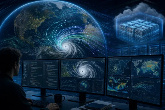 The release includes the model that ran in 2025
Google’s public GitHub repository distinguishes between several releases that are easy to blur together in press coverage. WeatherNext Cyclones is the specialized model family evaluated in the new paper; its 2025 checkpoint was the version run operationally during the 2025 Atlantic hurricane season. The repository says the National Hurricane Center’s postprocessed version carried the identifier GDMI, while Google referred to the live model internally as FNV3.
WeatherNext 2 is related but not identical. Google describes it as a later update operationalized in October 2025, capable of broader global atmospheric forecasting as well as cyclone forecasts. Its released 2025 model is a 0.25-degree system—roughly 30 km at the equator—fine-tuned on ECMWF HRES data and designed to start from operational HRES initial conditions rather than ERA5 reanalysis.
That last part has real consequences. The weights are available, but a user does not obtain a live independent forecasting operation simply by cloning the repository. To reproduce useful current forecasts, an organization needs timely initial-state data, sufficient compute, an inference pipeline, and procedures for interpreting ensemble output. Google makes forecast outputs available through Google Cloud, BigQuery, Earth Engine, Weather Lab, and Open-Meteo, but access to some data products is controlled through request forms and cloud services rather than being a download-and-run bundle.
The source code itself is under the Apache 2.0 license. The repository cautions that it is research code supplied as-is, with no guarantee of API stability, and recommends pinning deployments to a specific release. That is the right warning: anyone integrating it into a Windows-hosted research workflow or a production service should treat the release as a model implementation that requires validation and change control, not as a supported forecasting appliance.
A day of lead time is a measured claim, not a universal guarantee
Google’s headline claim is that WeatherNext Cyclones provides, on average, more than 24 hours of additional predictive lead time for storm track, intensity, and wind structure. Put plainly, its three-day forecast can match the accuracy other leading systems deliver at two days. The Nature paper reports that the system was evaluated on tropical cyclones from 2023 through 2025 and found a day or more of advantage over leading operational models.
The key word is average. It is not a promise that every forecast will be one day better, or that a local emergency manager can delay a decision by 24 hours. Tropical cyclone forecasting is probabilistic, and a forecast that gets a storm’s track right can still misjudge rapid intensification, wind radii, rainfall, or a landfall’s timing.
What WeatherNext changes is the ability to generate much larger ensembles quickly. Traditional global physics-based ensembles can require substantial supercomputer capacity, which constrains how many scenarios a forecasting center can run and analyze. Google says a single 15-day WeatherNext forecast takes less than one minute on a TPU; the cyclone system can now generate up to 1,000 possible scenarios, compared with the 50-member ensembles it used the prior year.
Those scenarios matter because forecasters do not only need the most likely track. They need to see credible, high-impact outliers: a sudden intensity jump, a slight track shift that moves damaging winds into a major population center, or a broader wind field than the median prediction suggests. The paper reports that adding WeatherNext Cyclones to a weighted consensus ensemble improved that consensus’ skill, which supports using the AI output as another input to forecaster judgment rather than treating it as a replacement forecast.
Hurricane Melissa is the operational proof point—and still needs context
Google has repeatedly pointed to Hurricane Melissa in October 2025 as the release’s real-world validation case. Its May account says WeatherNext predicted Melissa’s rapid intensification and Jamaica landfall at Category 5 strength five days ahead, assigning 80% confidence at that lead time and approaching 100% confidence three days before landfall. Google Research also said the National Hurricane Center used WeatherNext guidance alongside traditional physics-based models, satellite observations, and hurricane-hunter data.
The National Hurricane Center’s participation in the Nature paper matters here. NHC scientists are among the paper’s co-authors, and Google’s claims are not based solely on an internal benchmark. But the correct reading is narrower than “AI predicted the hurricane.” Forecast offices synthesize numerous models, observations, reconnaissance data, local expertise, and consensus guidance before issuing their own forecast products and warnings.
Melissa demonstrates why the model is interesting. Rapid intensification is one of the most difficult problems in tropical forecasting because the local processes governing a cyclone’s inner core are smaller and more turbulent than the large-scale atmospheric steering patterns that influence its track. Historically, the tools optimized for a global track forecast and the tools tuned for high-resolution intensity prediction have been separate systems with different trade-offs.
WeatherNext Cyclones attempts to bridge that divide in one learned model. It was trained jointly on nearly 20 TB of global atmospheric data and the IBTrACS archive of almost 5,000 historical storms. Google says that lets the system make joint predictions of track, intensity, and wind structure despite working from input fields at about 28 km resolution—far coarser than the regional models usually associated with intensity guidance.
The finding is scientifically interesting because it challenges the assumption that ever-finer resolution is the only route to stronger intensity forecasts. The paper’s authors explicitly say the result suggests coarse atmospheric data carries more intensity signal than previously recognized. They also say why the approach works as well as it does at that resolution remains an open research question. Open weights should make that question testable by people outside Google.
WeatherNext 2-mini lowers the barrier, but it is not a laptop model
Google calls the smaller release WeatherNext 2-mini in its announcement; the repository labels the available compact checkpoint WeatherNext Cyclones Mini. It runs at 1-degree resolution—about 111 km—and is intended for lower memory and compute requirements. Google’s documentation is direct that it is not expected to match the performance of the larger 0.25-degree models.
That trade-off is reasonable for education, pipeline prototyping, regression testing, and research that needs to inspect the model’s behavior without reserving premium accelerator capacity. It is also the default model in Google’s public Colab notebook. But it should not be sold as equivalent access to the system that assisted 2025 operations.
Google recommends a TPU wherever possible because the implementation is optimized for it. Its documentation says the Mini model should run on a P100 GPU, while the non-Mini variants need H100-class GPU memory if users do not have TPU access. There are no Windows-specific setup instructions in the project documentation, and the codebase depends on the JAX ecosystem, so Windows users should plan their environment before assuming native local deployment will be smooth.
For many organizations, the more practical use may be consuming forecast data or model output from an existing platform while independently evaluating performance against their own requirements. That includes comparing WeatherNext ensemble guidance with ECMWF, NOAA, regional agency, and in-house models—not merely checking whether its single deterministic-looking output matched a memorable storm.
The useful result is outside validation, not vendor substitution
The release gives universities, national meteorological agencies, nonprofits, and technically capable commercial forecasters something they did not previously have: the actual published model code and checkpoint weights behind Google’s claims. They can now audit preprocessing, rerun historical cases, test regional biases, assess calibration of rare-event probabilities, and examine whether the results hold when the model is combined with local data and operational workflows.
The open release does not remove the need for conventional numerical weather prediction. Physics-based models still provide a transparent, independently evolving foundation for operational forecasting, and the public should continue to rely on official national weather services for watches, warnings, and evacuation guidance. Google itself says the model is intended to support human forecasters, not issue official alerts.
For the Windows and infrastructure audience, the takeaway is practical: WeatherNext is worth evaluating if you have an accelerator-backed ML environment or need to build a weather-data pipeline, but it is not software to casually deploy on a workstation. The most important development is that its claims about cyclone guidance can now be independently reproduced—or challenged—before the next major storm turns a promising benchmark into an operational decision.
References
- Primary source: en.softonic.com
Published: August 10, 2026 at 9:20 AM UTC
Loading…
en.softonic.com - Related coverage: github.com
Loading…
github.com - Related coverage: developers.google.com
Loading…
developers.google.com - Related coverage: blog.google
Loading…
blog.google - Related coverage: github.com
Loading…
github.com - Related coverage: hurricanecity.com
Loading…
hurricanecity.com - Related coverage: blog.google
Loading…
blog.google - Related coverage: androidcentral.com
Loading…
www.androidcentral.com - Related coverage: research.google
Loading…
research.google - Related coverage: research.google
Loading…
research.google - Related coverage: sites.research.google
Loading…
sites.research.google - Related coverage: goraka.com
Loading…
goraka.com