

On May 28, 2026, the U.S. Department of the Interior announced the first publication of MAPLand and MAPWaters recreation access datasets, with an initial MAPLand Act Viewer scheduled to launch on June 1, 2026, for public land users across the United States. The news sounds bureaucratic because it is bureaucratic. But beneath the agency language is a very practical shift: the federal government is finally treating outdoor access information as infrastructure, not trivia. For hunters, hikers, anglers, overlanders, paddlers, land managers, app developers, and anyone who has ever wondered whether a road, trail, easement, or boat launch is actually open to the public, that matters.
For decades, Americans have been told that public lands belong to them. The harder question has often been how, exactly, they are supposed to get there.
The Department of the Interior’s MAPLand and MAPWaters rollout is an attempt to close that gap by digitizing and standardizing access information that has historically lived in scattered PDFs, paper files, local office records, legacy GIS layers, and institutional memory. That may sound like a narrow data-management exercise, but it goes directly to the daily experience of using federal lands and waters.
A parcel can be public in theory and effectively inaccessible in practice if the access road is unclear, the easement is buried in a land record, or the trail status differs between an agency map and a sign on the ground. Likewise, a waterway can be legally open but practically confusing if boat restrictions, fishing closures, or launch locations are not easy to find in one authoritative format.
The MAPLand Act and MAPWaters Act are designed to turn that messy reality into machine-readable, map-ready information. The promise is not merely prettier maps. It is fewer wrong turns, fewer accidental trespasses, fewer confrontations at gates, and fewer days lost to bad data.
That means web maps, GIS platforms, hunting apps, off-road navigation tools, agency trip planners, local tourism sites, and potentially the data stacks behind commercial outdoor recreation services. Once a federal dataset becomes standardized and reusable, it rarely stays confined to a government portal.
That is why this matters to a WindowsForum audience, even though the story begins in public lands policy rather than Windows itself. Modern recreation access is increasingly mediated through software: desktop GIS, mobile mapping apps, cloud-hosted tiles, offline map packages, agency APIs, and consumer navigation products. The boundary between “a government map” and “the app on your phone” is mostly a question of data availability and licensing.
For IT pros, the interesting part is the move from ad hoc documents to structured public data. For outdoor users, the interesting part is that a future map may finally answer the question they actually care about: can I legally go here today, by this route, with this activity?
Land ownership is one layer. Surface management is another. Easements are another. Roads and trails come with seasonal rules, use types, maintenance statuses, and agency-specific classifications. Hunting closures, recreational shooting restrictions, boat motor limits, and fishing rules can live in yet another set of systems.
The result has been a kind of mapping uncanny valley. Users can often see land boundaries with impressive precision, but the access rules around those boundaries may be ambiguous, outdated, or hidden in a document that was never designed for mobile use.
That fragmentation has real consequences. A hiker may see a public parcel but not the legal path to reach it. A hunter may see a road but not whether it is open to motorized travel. A paddler may find a reservoir but not know which launch is public or whether horsepower limits apply. A county sheriff, game warden, or land manager may then become the human API for questions that should have been answerable before anyone left home.
MAPLand and MAPWaters do not magically solve every dispute over access. They do, however, attack a more basic failure: too much authoritative information has been technically public but practically obscure.
An easement can be the difference between a public landscape that exists only as a colored shape on a map and one that people can actually visit. It can define where the public may cross private land, how that crossing may be used, and which agency holds the underlying right. In the West especially, where public and private parcels often interlock like a checkerboard, access easements are not a footnote. They are the hinge.
Yet easements have historically been hard for ordinary users to discover. Some are described in legal language rather than intuitive map features. Some are known locally but poorly surfaced nationally. Some may be represented in agency records but not in the consumer maps people consult before a trip.
Digitizing these records is therefore a significant move, but it also raises the stakes for accuracy. A wrong boundary or ambiguous restriction is not just an inconvenience. It can send a user onto private land, imply access where none exists, or conceal access that the public has legally secured.
That is why the early MAPLand datasets should be treated as foundational, not final. Public access mapping is not a one-time scan-and-publish job. It is an ongoing data maintenance problem with legal, operational, and human consequences.
The Bureau of Land Management, National Park Service, Fish and Wildlife Service, Bureau of Reclamation, U.S. Forest Service, and Army Corps of Engineers each bring different histories, systems, and field practices. A “road,” “trail,” “access point,” or “restricted area” can carry different meanings depending on the agency and the local management plan.
Standardization does not erase those differences. It creates a common data grammar so that differences can be represented consistently. That is what makes national-scale tools possible.
Without standards, the public gets a patchwork. With standards, developers and agencies can build interoperable systems. A trail closure in one jurisdiction and a road restriction in another do not become identical, but they can become comparable, searchable, and displayable in a coherent interface.
This is where the project becomes less about cartography and more about governance. Data standards are policy in machine-readable form. They decide what categories exist, what uncertainty is allowed, how restrictions are encoded, and whether a user can distinguish between legal access, administrative access, seasonal access, and no access at all.
But the word “initial” is doing a lot of work. The viewer should be understood as the beginning of a public feedback loop, not the completed product.
Federal datasets of this kind improve through exposure. Users notice gaps. Local offices identify mismatches. Partner agencies reconcile inconsistent records. Developers discover fields that need better documentation. Land managers learn which attributes the public actually relies on.
That process can be messy, but it is better than the alternative. A static official map that is wrong or incomplete is dangerous. A living platform with visible limitations, update cycles, and accountable source data is much more useful.
The challenge for Interior will be to resist the temptation to market the viewer as a single source of total certainty before the data deserves that status. The right posture is confidence in the direction of travel, paired with humility about the condition of legacy records.
For anglers and boaters, the question is rarely just “is this water public?” It is “where can I launch, what kind of craft can I use, can I run a motor, are there fishing restrictions, and are there closures in effect right now?”
That is a difficult data problem. Water access is dynamic, and the rules can change with season, species, water level, fire conditions, construction, invasive species controls, or special events. Publishing static points on a map is useful, but it is only a start.
The long-term value of MAPWaters will depend on whether agencies can represent restrictions in a way that is both precise and understandable. A paddler does not want to parse agency jargon in a parking lot with no signal. A fishing guide does not want to cross-check three PDFs before every trip. A family at a reservoir does not want to learn about a motor restriction after unloading the boat.
If MAPWaters succeeds, it will make public waters feel less like a regulatory scavenger hunt and more like a managed public resource with clear rules.
Outdoor recreation is an industry built partly on confidence. People buy gear, book lodging, hire guides, rent vehicles, pay entrance fees, and travel long distances when they believe they can reliably access the experience they are planning. Uncertain access suppresses that activity.
Local economies near federal lands often depend on visitors who are not experts in land records or agency boundaries. Clear maps can lower the barrier for newcomers while also reducing pressure on local staff who field repetitive access questions.
There is also an equity dimension, though agencies should be careful not to overclaim it. Better data does not eliminate transportation costs, physical barriers, permit limits, or uneven distribution of public lands. But it does reduce one barrier that disproportionately affects people without local knowledge: knowing where they are allowed to go.
The outdoor industry has understood this for years. Private apps have rushed to fill the information gap because public data was incomplete, scattered, or hard to use. MAPLand and MAPWaters could make the public baseline stronger, which in turn could make commercial tools more accurate and less dependent on proprietary reconstruction of public facts.
A shapefile or map service may satisfy a statutory milestone while remaining opaque to the person trying to plan a weekend trip. Field names, coded values, update dates, metadata quality, mobile performance, and plain-English explanations all determine whether the data works in practice.
The worst version of MAPLand would be a technically compliant data dump that transfers the burden of interpretation to users. The best version would combine authoritative GIS layers with clear provenance, intuitive symbology, update histories, and links back to responsible agencies.
There is also the issue of liability and trust. If a government viewer says access exists, users will treat that as meaningful. If the viewer is wrong, “check locally” disclaimers will not fully undo the damage. The more useful the system becomes, the more consequential its errors become.
That does not mean agencies should wait for perfection. It means they should publish with visible uncertainty. Users can handle caveats if they are specific. What they cannot handle is a map that looks authoritative while hiding its own incompleteness.
The question is whether agencies will design for that reality. Good APIs, stable schemas, documented change logs, and permissive access terms can turn MAPLand and MAPWaters into a platform. Poor documentation and brittle services can turn them into another frustrating government feed that developers scrape, patch, and complain about.
The consumer market is ready. Outdoor mapping apps already compete on land ownership overlays, offline navigation, hunting units, trail conditions, satellite imagery, weather, and route planning. Official access data can improve those products, but only if it is timely and technically dependable.
This is where IT governance becomes recreation policy. If the authoritative dataset is hard to use, the public will continue to rely on private aggregators that may or may not update quickly. If the authoritative dataset is easy to integrate, the same data can reach users through multiple channels: federal viewers, state portals, commercial apps, nonprofit tools, and local planning systems.
The federal government does not need to build the best outdoor app. It needs to publish the most reliable access data in forms that others can safely build upon.
Standardized MAPLand and MAPWaters layers could become routine inputs for county planners, search-and-rescue teams, outdoor recreation offices, conservation groups, and small businesses. That means the data will likely be downloaded, cached, transformed, joined, printed, and republished in many environments far beyond Interior’s viewer.
Offline use will be especially important. Many of the places where this data matters most have poor connectivity. A public access dataset that cannot be reliably taken into the field is less useful than one that can be packaged before a trip.
That creates familiar technical questions. How often should data be refreshed? How are stale offline copies flagged? Can users see the effective date of a restriction? Can agencies expose lightweight services for mobile use without sacrificing detail for professional GIS users?
Those are not glamorous questions, but they decide whether the project becomes trusted infrastructure or just another map people check once and abandon.
Some conflicts are not caused by missing information. They are caused by disagreement over law, resentment over land use, changing recreation patterns, crowding, vandalism, fire risk, wildlife impacts, or competing values. A clear map can reduce accidental conflict, but it cannot settle every argument over what access should exist.
In some places, better mapping may even surface tensions that were previously hidden. Publicizing an easement can bring more visitors to an area where nearby landowners were used to low traffic. Clarifying that a road is closed can frustrate users who believed it was open. Showing hunting or shooting restrictions more clearly can both reduce violations and provoke complaints.
That is not a reason to avoid transparency. It is a reason to pair transparency with management capacity. Data can tell people where they may go; agencies still need signs, maintenance, enforcement, and public engagement to make access work on the ground.
The map is not the territory, as the old phrase goes. In public land management, the map is increasingly the front door to the territory. If that door opens onto confusion, the consequences still happen outside.
Roads wash out. Trails are rerouted. Easements are acquired, corrected, challenged, or clarified. Seasonal closures change. Fire restrictions appear quickly. Water access can be affected by drought, construction, safety hazards, or changing resource conditions.
A dataset that is accurate in June can be misleading by September if the update pipeline is weak. That is why agencies need not only digitization funding but sustained operational workflows. Someone has to own the data after the ribbon-cutting.
The most credible version of MAPLand and MAPWaters would make update dates obvious, distinguish permanent rules from temporary closures, and show which agency is responsible for each feature. Users should not have to guess whether a layer was updated last week or last administration.
This is also where Congress and agency leadership matter after the press release fades. Modernizing access data is not a one-time modernization. It is a permanent obligation created by the decision to make digital maps part of how the public experiences public lands.
That expectation will fall on federal agencies first, but not only on them. State agencies, counties, app makers, guide services, advocacy groups, and recreation communities will all start comparing their own maps against the new federal baseline. Inconsistencies will become more visible.
That is healthy, but uncomfortable. It will expose data gaps that were previously hidden by fragmentation. It will force agencies to explain why one map says a route is open and another says it is closed. It will make outdated third-party products easier to criticize.
In technology terms, MAPLand and MAPWaters are creating a new source of truth. In public land terms, they are creating a new arena for accountability.
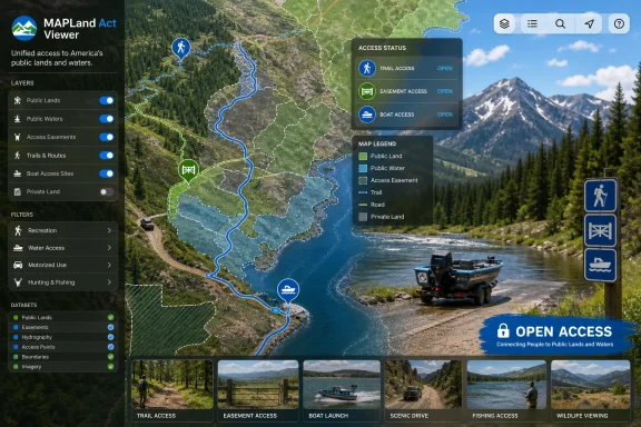 The Map Is Becoming Part of the Public Land System
For decades, Americans have been told that public lands belong to them. The harder question has often been how, exactly, they are supposed to get there.The Department of the Interior’s MAPLand and MAPWaters rollout is an attempt to close that gap by digitizing and standardizing access information that has historically lived in scattered PDFs, paper files, local office records, legacy GIS layers, and institutional memory. That may sound like a narrow data-management exercise, but it goes directly to the daily experience of using federal lands and waters.
A parcel can be public in theory and effectively inaccessible in practice if the access road is unclear, the easement is buried in a land record, or the trail status differs between an agency map and a sign on the ground. Likewise, a waterway can be legally open but practically confusing if boat restrictions, fishing closures, or launch locations are not easy to find in one authoritative format.
The MAPLand Act and MAPWaters Act are designed to turn that messy reality into machine-readable, map-ready information. The promise is not merely prettier maps. It is fewer wrong turns, fewer accidental trespasses, fewer confrontations at gates, and fewer days lost to bad data.
A Government Mapping Project With Consumer Consequences
This is the sort of federal announcement that can look sleepy until you think about where the data will end up. Interior’s initial datasets and the forthcoming MAPLand Act Viewer are only the visible federal layer. The larger effect will come when standardized access data begins feeding the mapping tools people already use.That means web maps, GIS platforms, hunting apps, off-road navigation tools, agency trip planners, local tourism sites, and potentially the data stacks behind commercial outdoor recreation services. Once a federal dataset becomes standardized and reusable, it rarely stays confined to a government portal.
That is why this matters to a WindowsForum audience, even though the story begins in public lands policy rather than Windows itself. Modern recreation access is increasingly mediated through software: desktop GIS, mobile mapping apps, cloud-hosted tiles, offline map packages, agency APIs, and consumer navigation products. The boundary between “a government map” and “the app on your phone” is mostly a question of data availability and licensing.
For IT pros, the interesting part is the move from ad hoc documents to structured public data. For outdoor users, the interesting part is that a future map may finally answer the question they actually care about: can I legally go here today, by this route, with this activity?
The Old System Was Not Broken So Much as Fragmented
The federal government already has plenty of maps. The problem has been that access is not one dataset.Land ownership is one layer. Surface management is another. Easements are another. Roads and trails come with seasonal rules, use types, maintenance statuses, and agency-specific classifications. Hunting closures, recreational shooting restrictions, boat motor limits, and fishing rules can live in yet another set of systems.
The result has been a kind of mapping uncanny valley. Users can often see land boundaries with impressive precision, but the access rules around those boundaries may be ambiguous, outdated, or hidden in a document that was never designed for mobile use.
That fragmentation has real consequences. A hiker may see a public parcel but not the legal path to reach it. A hunter may see a road but not whether it is open to motorized travel. A paddler may find a reservoir but not know which launch is public or whether horsepower limits apply. A county sheriff, game warden, or land manager may then become the human API for questions that should have been answerable before anyone left home.
MAPLand and MAPWaters do not magically solve every dispute over access. They do, however, attack a more basic failure: too much authoritative information has been technically public but practically obscure.
Easements Are the Quiet Center of the Story
Interior’s announcement specifically notes the publication of easement information, and that is not incidental. Easements are where the abstraction of public access becomes concrete.An easement can be the difference between a public landscape that exists only as a colored shape on a map and one that people can actually visit. It can define where the public may cross private land, how that crossing may be used, and which agency holds the underlying right. In the West especially, where public and private parcels often interlock like a checkerboard, access easements are not a footnote. They are the hinge.
Yet easements have historically been hard for ordinary users to discover. Some are described in legal language rather than intuitive map features. Some are known locally but poorly surfaced nationally. Some may be represented in agency records but not in the consumer maps people consult before a trip.
Digitizing these records is therefore a significant move, but it also raises the stakes for accuracy. A wrong boundary or ambiguous restriction is not just an inconvenience. It can send a user onto private land, imply access where none exists, or conceal access that the public has legally secured.
That is why the early MAPLand datasets should be treated as foundational, not final. Public access mapping is not a one-time scan-and-publish job. It is an ongoing data maintenance problem with legal, operational, and human consequences.
Standardization Is the Unsexy Breakthrough
The most important word in Interior’s announcement may be standardized. Federal land agencies do not all manage the same kinds of places, and they do not all describe recreation in the same operational language.The Bureau of Land Management, National Park Service, Fish and Wildlife Service, Bureau of Reclamation, U.S. Forest Service, and Army Corps of Engineers each bring different histories, systems, and field practices. A “road,” “trail,” “access point,” or “restricted area” can carry different meanings depending on the agency and the local management plan.
Standardization does not erase those differences. It creates a common data grammar so that differences can be represented consistently. That is what makes national-scale tools possible.
Without standards, the public gets a patchwork. With standards, developers and agencies can build interoperable systems. A trail closure in one jurisdiction and a road restriction in another do not become identical, but they can become comparable, searchable, and displayable in a coherent interface.
This is where the project becomes less about cartography and more about governance. Data standards are policy in machine-readable form. They decide what categories exist, what uncertainty is allowed, how restrictions are encoded, and whether a user can distinguish between legal access, administrative access, seasonal access, and no access at all.
The June 1 Viewer Is a Milestone, Not the Finish Line
The planned June 1, 2026 launch of the initial MAPLand Act Viewer gives the project a public face. That timing, at the start of Great Outdoors Month, is politically tidy and practically useful. Summer is when many Americans start asking where they can camp, hike, ride, fish, boat, and shoot.But the word “initial” is doing a lot of work. The viewer should be understood as the beginning of a public feedback loop, not the completed product.
Federal datasets of this kind improve through exposure. Users notice gaps. Local offices identify mismatches. Partner agencies reconcile inconsistent records. Developers discover fields that need better documentation. Land managers learn which attributes the public actually relies on.
That process can be messy, but it is better than the alternative. A static official map that is wrong or incomplete is dangerous. A living platform with visible limitations, update cycles, and accountable source data is much more useful.
The challenge for Interior will be to resist the temptation to market the viewer as a single source of total certainty before the data deserves that status. The right posture is confidence in the direction of travel, paired with humility about the condition of legacy records.
MAPWaters Extends the Same Fight to Rivers, Lakes, and Reservoirs
MAPWaters is a natural companion to MAPLand because water access can be even more confusing than land access. Rivers cross jurisdictions. Reservoirs may be managed by federal agencies but shaped by state law, local rules, tribal interests, concession agreements, and seasonal safety restrictions.For anglers and boaters, the question is rarely just “is this water public?” It is “where can I launch, what kind of craft can I use, can I run a motor, are there fishing restrictions, and are there closures in effect right now?”
That is a difficult data problem. Water access is dynamic, and the rules can change with season, species, water level, fire conditions, construction, invasive species controls, or special events. Publishing static points on a map is useful, but it is only a start.
The long-term value of MAPWaters will depend on whether agencies can represent restrictions in a way that is both precise and understandable. A paddler does not want to parse agency jargon in a parking lot with no signal. A fishing guide does not want to cross-check three PDFs before every trip. A family at a reservoir does not want to learn about a motor restriction after unloading the boat.
If MAPWaters succeeds, it will make public waters feel less like a regulatory scavenger hunt and more like a managed public resource with clear rules.
Outdoor Recreation Is Now a Data Economy
Secretary Doug Burgum framed the initiative around helping Americans spend less time searching for information and more time outside. That is the public-facing version of the argument, and it is fair enough. But the economic stakes are broader.Outdoor recreation is an industry built partly on confidence. People buy gear, book lodging, hire guides, rent vehicles, pay entrance fees, and travel long distances when they believe they can reliably access the experience they are planning. Uncertain access suppresses that activity.
Local economies near federal lands often depend on visitors who are not experts in land records or agency boundaries. Clear maps can lower the barrier for newcomers while also reducing pressure on local staff who field repetitive access questions.
There is also an equity dimension, though agencies should be careful not to overclaim it. Better data does not eliminate transportation costs, physical barriers, permit limits, or uneven distribution of public lands. But it does reduce one barrier that disproportionately affects people without local knowledge: knowing where they are allowed to go.
The outdoor industry has understood this for years. Private apps have rushed to fill the information gap because public data was incomplete, scattered, or hard to use. MAPLand and MAPWaters could make the public baseline stronger, which in turn could make commercial tools more accurate and less dependent on proprietary reconstruction of public facts.
The Risk Is That “Open Data” Becomes “Dumped Data”
There is a difference between publishing data and making it usable. Federal agencies know this, but large public data projects still stumble when the metric becomes release count rather than public comprehension.A shapefile or map service may satisfy a statutory milestone while remaining opaque to the person trying to plan a weekend trip. Field names, coded values, update dates, metadata quality, mobile performance, and plain-English explanations all determine whether the data works in practice.
The worst version of MAPLand would be a technically compliant data dump that transfers the burden of interpretation to users. The best version would combine authoritative GIS layers with clear provenance, intuitive symbology, update histories, and links back to responsible agencies.
There is also the issue of liability and trust. If a government viewer says access exists, users will treat that as meaningful. If the viewer is wrong, “check locally” disclaimers will not fully undo the damage. The more useful the system becomes, the more consequential its errors become.
That does not mean agencies should wait for perfection. It means they should publish with visible uncertainty. Users can handle caveats if they are specific. What they cannot handle is a map that looks authoritative while hiding its own incompleteness.
The Private Sector Will Build on This Whether Agencies Plan for It or Not
Once standardized federal recreation data is public, third-party developers will ingest it. That is not a side effect; it is part of the point.The question is whether agencies will design for that reality. Good APIs, stable schemas, documented change logs, and permissive access terms can turn MAPLand and MAPWaters into a platform. Poor documentation and brittle services can turn them into another frustrating government feed that developers scrape, patch, and complain about.
The consumer market is ready. Outdoor mapping apps already compete on land ownership overlays, offline navigation, hunting units, trail conditions, satellite imagery, weather, and route planning. Official access data can improve those products, but only if it is timely and technically dependable.
This is where IT governance becomes recreation policy. If the authoritative dataset is hard to use, the public will continue to rely on private aggregators that may or may not update quickly. If the authoritative dataset is easy to integrate, the same data can reach users through multiple channels: federal viewers, state portals, commercial apps, nonprofit tools, and local planning systems.
The federal government does not need to build the best outdoor app. It needs to publish the most reliable access data in forms that others can safely build upon.
Windows Users Will Meet This Through GIS, Browsers, and Offline Maps
For Windows enthusiasts and IT professionals, the most immediate touchpoint may be desktop GIS. ArcGIS Pro, QGIS, browser-based viewers, and internal agency tools are still central to how land managers, analysts, and local governments work with spatial data.Standardized MAPLand and MAPWaters layers could become routine inputs for county planners, search-and-rescue teams, outdoor recreation offices, conservation groups, and small businesses. That means the data will likely be downloaded, cached, transformed, joined, printed, and republished in many environments far beyond Interior’s viewer.
Offline use will be especially important. Many of the places where this data matters most have poor connectivity. A public access dataset that cannot be reliably taken into the field is less useful than one that can be packaged before a trip.
That creates familiar technical questions. How often should data be refreshed? How are stale offline copies flagged? Can users see the effective date of a restriction? Can agencies expose lightweight services for mobile use without sacrificing detail for professional GIS users?
Those are not glamorous questions, but they decide whether the project becomes trusted infrastructure or just another map people check once and abandon.
Access Data Will Not End Access Conflict
It is tempting to imagine that better maps will make public land disputes disappear. They will not.Some conflicts are not caused by missing information. They are caused by disagreement over law, resentment over land use, changing recreation patterns, crowding, vandalism, fire risk, wildlife impacts, or competing values. A clear map can reduce accidental conflict, but it cannot settle every argument over what access should exist.
In some places, better mapping may even surface tensions that were previously hidden. Publicizing an easement can bring more visitors to an area where nearby landowners were used to low traffic. Clarifying that a road is closed can frustrate users who believed it was open. Showing hunting or shooting restrictions more clearly can both reduce violations and provoke complaints.
That is not a reason to avoid transparency. It is a reason to pair transparency with management capacity. Data can tell people where they may go; agencies still need signs, maintenance, enforcement, and public engagement to make access work on the ground.
The map is not the territory, as the old phrase goes. In public land management, the map is increasingly the front door to the territory. If that door opens onto confusion, the consequences still happen outside.
The Real Test Is Maintenance
The first publication of datasets is news. The maintenance regime will determine whether it was important.Roads wash out. Trails are rerouted. Easements are acquired, corrected, challenged, or clarified. Seasonal closures change. Fire restrictions appear quickly. Water access can be affected by drought, construction, safety hazards, or changing resource conditions.
A dataset that is accurate in June can be misleading by September if the update pipeline is weak. That is why agencies need not only digitization funding but sustained operational workflows. Someone has to own the data after the ribbon-cutting.
The most credible version of MAPLand and MAPWaters would make update dates obvious, distinguish permanent rules from temporary closures, and show which agency is responsible for each feature. Users should not have to guess whether a layer was updated last week or last administration.
This is also where Congress and agency leadership matter after the press release fades. Modernizing access data is not a one-time modernization. It is a permanent obligation created by the decision to make digital maps part of how the public experiences public lands.
The First Datasets Put a New Burden on Every Map
Interior’s announcement should be read as a shift in expectations, not just a release note. Once the government begins publishing standardized access layers, users will reasonably expect public maps to get better.That expectation will fall on federal agencies first, but not only on them. State agencies, counties, app makers, guide services, advocacy groups, and recreation communities will all start comparing their own maps against the new federal baseline. Inconsistencies will become more visible.
That is healthy, but uncomfortable. It will expose data gaps that were previously hidden by fragmentation. It will force agencies to explain why one map says a route is open and another says it is closed. It will make outdated third-party products easier to criticize.
In technology terms, MAPLand and MAPWaters are creating a new source of truth. In public land terms, they are creating a new arena for accountability.
The Practical Promise Is Modest, Which Is Why It Matters
The most concrete lesson from the MAPLand and MAPWaters rollout is that access modernization is less about grand digital transformation than about making basic public facts easier to use. That modesty is its strength.- The first MAPLand and MAPWaters datasets mark the beginning of a phased federal effort, not the completion of a national recreation access map.
- The planned June 1, 2026 MAPLand Act Viewer should give the public an early interface for access data, but its usefulness will depend on coverage, clarity, and update discipline.
- Easement data is especially important because it can reveal legal public access routes that ordinary users might otherwise never discover.
- Standardized formats matter because public land and water access crosses agency boundaries, and fragmented systems have long made recreation planning harder than it should be.
- Third-party mapping apps and GIS users are likely to amplify the impact of the datasets if the government provides stable, well-documented, and regularly maintained services.
- Better maps will reduce confusion, but they will not replace signs, enforcement, local knowledge, or the hard management decisions that come with crowded public places.
References
- Primary source: HPCwire
Published: 2026-05-29T23:59:15.593564
BigDATAwire - Data Science • AI • Advanced Analytics
WASHINGTON, May 29, 2026 — The U.S. Department of the Interior has announced progress in implementing the Modernizing Access to Our Public Land (MAPLand) Act and the Modernizing Access to Our […]www.hpcwire.com - Related coverage: doi.gov
Interior Advances Public Access to Recreation Data with New Mapping Milestone | U.S. Department of the Interior
The Department of the Interior today announced progress in implementing the Modernizing Access to Our Public Land (MAPLand) Act and the Modernizing Access to Our Public Waters (MAPWaters) Act, including the initial publication of recreation access data and the planned launch of a new...www.doi.gov - Related coverage: gis.test.blm.gov
- Related coverage: fws.gov
- Related coverage: trcp.org
MAPping Public Access | Theodore Roosevelt Conservation Partnership
Improving clarity around public hunting and fishing access on federal lands and waters. This clarity will help Americans enjoy the outdoors.www.trcp.org - Related coverage: fgdc.gov
